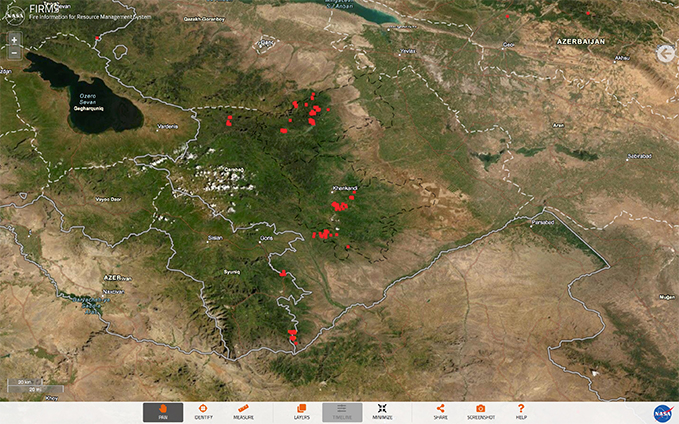
The map of NASA FIRMS (Fire Information for Resource Management System) shows areas of fire burning in the last 24 hours in Nagorno-Karabakh, according to photos published by ELINT NEWS on Twitter.
This could outline the approximate frontlines of battles and areas of artillery fire, which means certain border areas in Armenia's south have also come under fire.
The Nagorno-Karabakh Defense Army said Sunday, November 1 morning that the Azerbaijani military attempted to advance near the villages of Avetaranots and Sghnakh with the support of close to 10 pieces of combat vehicles overnight but were thrown back by the Armenian troops.
Throughout the night, fighting continued in the southwestern, southeastern, and northern directions of the frontline.
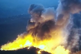
Azerbaijan also continued shelling the civilian settlements of Artsakh (Karabakh), delivering rocket and artillery strikes on the towns of Martuni, Shushi, as well as the village of Karin Tak. Enemy fire positions in those directions have come under the Defense Army units’ pinpoint strikes.
Azerbaijan, with help from Turkey and Syrian and Libyan mercenaries deployed by Ankara, started a war against Karabakh (Artsakh) in the morning of September 27. The Armenian side has reported deaths and injuries both among the civilian population and the military. Foreign and local journalists too have been injured in Azeri shelling of towns and villages.